Eyes in the Sky: Drone Mapping for Reef Conservation
Have you ever wondered what a seabird’s-eye view of a coral reef would look like? Marine Conservation Philippines is out to find out! Updating and diversifying our library of photos is an important part of our ongoing mission to expand our knowledge of the marine environments of Negros Oriental. We routinely photograph everything from daily goings on (frequently posted on our social media channels) to our surveys and the marine ecosystems of our region. These photos serve a multitude of different purposes, including scientific documentation, education, training, social media promotion, and coastal ecosystem mapping. Our most recent initiative has been to expand our photographic documentation of our dive sites, this time from the air, via drone photography.
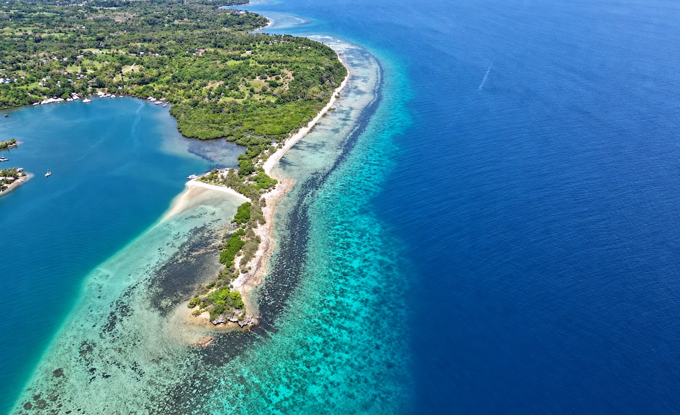
The view looking northeast from Sitio Polo and the Lutoban MPA toward Zamboanguita, Apo Island and Siquijor. This section of coastline is an excellent example of the typical topography of our local fringing reefs. A short sandy beach slopes down to a flat and shallow rocky reef crest, which gives way to a gently sloping reef.
Aside from providing us with beautiful images to share, drone photography grants us new methods to track ecosystem changes over time and to make detailed, accurate, and up-to-date maps of our survey sites. These maps, in turn, help us to plan our dives and orient our divers when they are ready for the scientific work, after passing their PADI courses. Things like site topography, Marine Protected Area boundaries, survey zones, beach access points, and environmental hazards all become much easier to visualize and plan around with the help of these highly detailed visual aids.

MCP almost exclusively conducts shore dive surveys over rocky fringing reefs, making safe entry and exit points a vital consideration. Aerial photos, like this one of Salag MPA, provide insight and visual references into the best ways to safely enter and exit the water at low tide. Note the pale channels of sand near the beach.
Drone use around protected coastal areas in the Philippines can come with its own set of rules. Tubbataha Reefs Natural Park, for example, requires operators to apply for a permit at least two weeks in advance of any flight. Our own dive sites don’t fall under that kind of restriction, but our pilots still take every reasonable precaution: keeping a respectful distance from coastal settlements, and staying mindful not to disturb local residents going about their day.
As we continue to build a larger library of aerial photographs, we aim to combine drone photography, GPS data, and our ongoing data collection to add new dimensions to our projects. New techniques (we recently added a water sensor array to our dive kits, for example) allow us to interface with and present our data in new ways, making our scientific communication, community engagement, and environmental monitoring efforts more effective! For now, drone photography is a tool that makes the everyday lives of our volunteer scuba divers and staff easier and safer, by helping us map out the safest ways to access and delineate our study sites. It’s one more piece of the same picture: the clearer our view of Negros Oriental’s coastline, the better placed we are to protect it, for the reefs, and for the communities who depend on them.